The Philippine archipelago stands as one of Earth’s most remarkable biodiversity sanctuaries, where over 7,641 islands harbour an extraordinary tapestry of endemic species, pristine ecosystems, and geological wonders. This tropical paradise sits at the heart of the Coral Triangle, supporting marine life densities that rival any destination on the planet whilst simultaneously offering terrestrial landscapes that range from ancient volcanic peaks to mystical underground river systems.
For nature enthusiasts and intrepid explorers, the Philippines presents an unparalleled opportunity to witness evolution in action. The archipelago’s isolation has fostered the development of species found nowhere else on Earth, creating living laboratories where conservation efforts intersect with sustainable tourism practices. From the world’s smallest primate to gentle whale sharks, from perfect volcanic cones to limestone formations that defy imagination, this Southeast Asian gem continues to reveal new secrets to those willing to venture beyond conventional tourist trails.
Biodiversity hotspots and endemic species conservation in philippine archipelago
The Philippines ranks among the world’s 17 megadiverse countries, hosting approximately 52,177 described species with an estimated 60% endemism rate. This extraordinary biological richness stems from the archipelago’s complex geological history and varied microclimates, creating isolated pockets where species have evolved independently for millions of years. The country’s biodiversity hotspots serve as critical conservation areas, protecting ecosystems that support both endemic wildlife and local communities dependent on natural resources.
Scientific research indicates that new species discoveries occur regularly across Philippine territories, with marine environments yielding particularly significant finds. Recent studies have documented over 2,400 fish species in Philippine waters alone, whilst terrestrial surveys continue revealing previously unknown plant varieties, particularly in montane forest ecosystems. This ongoing discovery process highlights the urgent need for comprehensive conservation strategies that balance ecological protection with sustainable development initiatives.
Palawan biosphere reserve and puerto princesa subterranean river national park
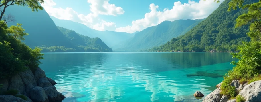
Palawan’s pristine landscapes encompass both terrestrial and marine protected areas that showcase the Philippines’ most diverse ecosystems. The Puerto Princesa Subterranean River National Park, recognised as a UNESCO World Heritage Site, protects an 8.2-kilometre underground river system flowing directly into the South China Sea. This unique geological formation supports endemic cave-dwelling species whilst providing critical habitat for various wildlife populations, including monitor lizards, long-tailed macaques, and over 165 bird species.
The broader Palawan Biosphere Reserve extends across 1.15 million hectares, incorporating marine protected areas that safeguard critical spawning grounds for commercially important fish species. Conservation efforts here focus on community-based management approaches, where indigenous communities play vital roles in monitoring wildlife populations and preventing illegal fishing activities. These collaborative initiatives have proven particularly effective in maintaining ecological integrity whilst supporting local livelihoods through sustainable tourism and fishing practices.
Mount hamiguitan range wildlife sanctuary endemic flora distribution
The Mount Hamiguitan Range Wildlife Sanctuary in Mindanao represents one of the Philippines’ most remarkable centres of plant endemism, hosting over 1,400 vascular plant species within its 6,834-hectare protected area. This UNESCO World Heritage Site encompasses diverse forest types, from lowland dipterocarp forests to montane cloud forests, each supporting distinct assemblages of endemic flora and fauna. Scientific surveys have identified numerous critically endangered species within the sanctuary, including several pitcher plant varieties and endemic orchid species found nowhere else globally.
Conservation challenges in Mount Hamiguitan include habitat fragmentation due to agricultural expansion and climate change impacts affecting montane ecosystems. Research programmes currently monitor temperature and precipitation patterns to assess how changing climatic conditions influence endemic species distributions. These studies provide crucial data for developing adaptive management strategies that ensure long-term species survival whilst maintaining ecosystem services vital for surrounding communities.
Tubbataha reefs natural park marine biodiversity assessment
Tubbataha Reefs Natural Park encompasses 97,030 hectares of pristine marine habitat in the Sulu Sea, supporting the highest diversity of marine life in the Philippines. This remote atoll system hosts over 600 fish species, 360 coral species, and serves as critical habitat for endangered marine megafauna including green sea turtles, hawksbill turtles, and various shark species. The park’s isolation provides natural protection from human disturbances, allowing marine ecosystems to function with minimal anthropogenic impacts.
Recent biodiversity assessments reveal that Tubbataha’s coral coverage remains among the healthiest in Southeast Asia, with live coral coverage exceeding 50% in many areas. Marine conservation efforts focus on maintaining strict no-take zones whilst conducting regular monitoring programmes to track population trends for key indicator species. These initiatives have contributed to measurable increases in fish biomass and coral recruitment rates, demonstrating the effectiveness of comprehensive marine protection strategies in Philippine waters.
Northern sierra madre natural park luzon endemic bird species
The Northern Sierra Madre Natural Park encompasses 359,486 hectares of Luzon’s most biodiverse terrestrial ecosystems, providing critical habitat for 17 endemic bird species including the Philippine Eagle, considered the country’s national bird. This vast protected area supports intact forest ecosystems that serve as vital watersheds for surrounding agricultural communities whilst maintaining connectivity corridors essential for wide-ranging species movements. Endemic bird populations here face ongoing pressures from habitat conversion and hunting activities, necessitating intensive conservation interventions.
Avian research programmes utilise advanced radio-telemetry techniques to monitor Philippine Eagle movements and breeding behaviour, providing insights into habitat requirements and territorial needs. Conservation organisations work closely with indigenous communities to develop sustainable livelihood alternatives that reduce dependence on forest resources whilst maintaining cultural connections to ancestral lands. These collaborative approaches have proven essential for achieving long-term conservation success in complex socio-ecological systems where human communities and wildlife share limited habitat space.
Donsol whale shark interaction zone conservation protocols
Donsol’s whale shark interaction programme represents a globally recognised model for sustainable wildlife tourism that directly benefits local communities whilst supporting marine conservation objectives. Strict protocols limit daily visitor numbers to 60 participants, with mandatory briefings ensuring minimal disturbance to whale shark behaviour. Local fishermen serve as trained boat operators and wildlife guides, transforming traditional fishing practices into conservation-oriented tourism activities that provide stable year-round income.
Scientific monitoring indicates that Donsol’s whale shark population includes over 100 individual animals, with photo-identification studies tracking movement patterns and residency times. Conservation efforts extend beyond tourism management to include habitat protection initiatives targeting critical feeding areas and migration corridors. These comprehensive approaches have maintained stable whale shark visitation rates whilst demonstrating how community-based conservation can achieve measurable biodiversity outcomes through carefully managed wildlife tourism programmes.
Geological formation and karst landscape exploration opportunities
The Philippines’ position along the Pacific Ring of Fire has created a geological wonderland characterised by active volcanism, extensive limestone formations, and complex tectonic processes that continue shaping the archipelago’s landscapes. These dynamic geological processes have produced some of the world’s most spectacular karst formations, underground river systems, and volcanic features that attract geologists and adventure seekers from across the globe. The country’s limestone terrains, covering approximately 15% of total land area, support unique ecosystems adapted to calcium-rich soils and underground water systems.
Karst landscapes in the Philippines offer exceptional opportunities for speleological exploration, with thousands of documented caves containing pristine formations and endemic cave-dwelling species. Many cave systems remain unexplored, presenting ongoing opportunities for scientific discovery and adventure tourism development. These geological features also provide critical water resources for rural communities, highlighting the importance of balancing conservation efforts with sustainable resource management practices that ensure long-term ecosystem health.
Bohol chocolate hills limestone cone karst morphology
The Chocolate Hills formation represents one of the Philippines’ most iconic geological phenomena, comprising 1,268 individual cone-shaped hills spread across 50 square kilometres of Bohol’s interior landscape. These limestone formations result from millions of years of coral reef uplift and subsequent weathering processes that created uniform conical shapes ranging from 30 to 50 metres in height. During the dry season, grass covering these hills transforms from green to chocolate brown, creating the distinctive appearance that gives this geological wonder its name.
Geological research indicates that the Chocolate Hills formed through marine limestone deposition during the Pliocene epoch, followed by tectonic uplift and extensive chemical weathering. The uniform spacing and similar heights suggest complex hydrological processes influenced their development, with underground drainage patterns playing crucial roles in shaping individual hill morphology. These formations support endemic plant species adapted to shallow soils and seasonal moisture variations, creating unique ecological niches within the broader limestone landscape ecosystem.
Sagada hanging coffins cave system speleological features
Sagada’s extensive cave systems combine remarkable speleological features with significant cultural heritage, where indigenous Igorot communities have practiced cliff burial traditions for over 2,000 years. The region’s limestone geology has created interconnected cave networks exceeding 60 kilometres in total mapped passages, including Sumaging Cave’s cathedral-like chambers and Connection Cave’s challenging underground rivers. These cave systems showcase diverse speleothem formations including flowstones, stalactites, and rare cave pearls formed under specific hydrological conditions.
Speleological surveys continue revealing new passages and chambers within Sagada’s cave networks, with recent discoveries including underground waterfalls and pristine formation galleries. The caves support endemic invertebrate species adapted to perpetual darkness, including several undescribed spider and arthropod species currently under taxonomic study. Conservation efforts balance cultural preservation requirements with scientific research needs, ensuring that traditional burial practices continue alongside responsible cave exploration activities that minimise environmental impacts.
Banaue rice terraces ifugao cultural landscape engineering
The Banaue Rice Terraces represent a 2,000-year-old example of sustainable landscape engineering that transforms steep mountain slopes into productive agricultural systems whilst preventing soil erosion and maintaining watershed functions. These ancient terraces cover approximately 20,000 hectares across the Cordillera Mountains, utilising sophisticated irrigation systems called “balanghoy” that channel mountain spring water through precisely graded channels to individual terrace levels. The engineering precision required to maintain consistent water flow across hundreds of terrace levels demonstrates remarkable hydraulic knowledge developed by indigenous Ifugao communities.
UNESCO World Heritage designation recognises both the outstanding cultural value and sophisticated ecological engineering represented by the Ifugao terrace systems. Modern engineering studies reveal that the terraces effectively control erosion whilst supporting biodiversity through habitat creation for various aquatic and terrestrial species. However, these systems face ongoing challenges from outmigration of young Ifugao community members and competition from modern agricultural practices, threatening the traditional knowledge essential for maintaining complex irrigation systems that have sustained mountain communities for millennia.
Hundred islands national park quaternary coral reef formations
The Hundred Islands National Park showcases remarkable examples of ancient coral reef formations uplifted during Quaternary tectonic activity, creating 124 individual limestone islets scattered across Lingayen Gulf. These mushroom-shaped formations result from differential erosion processes that created undercut bases supporting enlarged caps, producing distinctive geological profiles unique to this region. Each island supports distinct microhabitats ranging from intertidal zones to elevated forest communities, creating exceptional biodiversity within a relatively compact area.
Marine environments surrounding the limestone islands support healthy coral reef ecosystems that contrast sharply with the ancient fossil reefs comprising the islands themselves. This juxtaposition provides exceptional opportunities for studying coral reef evolution and adaptation processes across geological timescales. Scientific research focuses on understanding how past climate changes influenced reef development whilst examining current coral community responses to modern environmental pressures including ocean acidification and temperature fluctuations that threaten contemporary marine ecosystem stability .
Marine ecosystem diversity and coral triangle positioning
The Philippines occupies a central position within the Coral Triangle, often referred to as the “Amazon of the Seas” due to its extraordinary marine biodiversity that exceeds any other oceanic region globally. This strategic location supports over 2,400 fish species and 500 coral species, representing approximately 75% of all known coral species worldwide. The archipelago’s complex oceanographic conditions, including seasonal monsoons, upwelling zones, and varied depth profiles, create diverse marine habitats that range from shallow coral gardens to deep-sea trenches exceeding 10,000 metres in depth.
Marine connectivity patterns within Philippine waters facilitate larval dispersal across vast distances, supporting genetic diversity essential for ecosystem resilience. Ocean currents transport marine larvae between distant reef systems, creating interconnected networks that span the entire archipelago. However, these same connectivity patterns also facilitate the spread of marine invasive species and pollution impacts, highlighting the need for comprehensive regional management approaches that coordinate conservation efforts across multiple jurisdictions and stakeholder groups.
Climate change impacts pose increasing challenges to Philippine marine ecosystems, with coral bleaching events becoming more frequent and severe during recent decades. Rising ocean temperatures, combined with ocean acidification and increased storm intensity, threaten the structural integrity of coral reef ecosystems that support both marine biodiversity and coastal community livelihoods. Research programmes currently monitor coral resilience mechanisms whilst developing assisted migration strategies that may help coral communities adapt to changing environmental conditions.
Marine protected area networks across the Philippines encompass approximately 1.8 million hectares of critical marine habitat, though coverage remains insufficient to ensure ecosystem-wide conservation. Effective marine protection requires coordinated management across multiple scales, from small community-managed sanctuaries to large national parks that protect entire reef systems. Success stories from community-based marine conservation initiatives demonstrate how local stewardship can achieve measurable biodiversity outcomes whilst providing sustainable livelihood opportunities for fishing communities dependent on healthy marine ecosystems .
Volcanic activity and geothermal adventure tourism infrastructure
The Philippines hosts 53 active volcanoes distributed across the archipelago, creating exceptional opportunities for adventure tourism whilst providing insights into dynamic geological processes that shape island landscapes. These volcanic systems contribute significantly to the country’s renewable energy portfolio through geothermal power generation, whilst simultaneously supporting unique ecosystems adapted to volcanic soils and thermal environments. Volcanic landscapes offer diverse adventure activities including crater hiking, hot spring exploration, and lava tube caving that attract international visitors seeking authentic geological experiences.
Volcanic hazard monitoring systems provide essential safety information for both residents and tourists, utilising advanced seismic monitoring networks and gas emission measurements to track volcanic activity levels. The Philippine Institute of Volcanology and Seismology maintains continuous surveillance of active volcanoes, issuing regular bulletins that inform tourism operators and adventure guides about current risk conditions. This comprehensive monitoring infrastructure enables safe access to volcanic landscapes whilst ensuring rapid response capabilities during periods of increased volcanic activity.
Mayon volcano perfect cone stratovolcano trekking routes
Mayon Volcano’s geometrically perfect cone shape, rising 2,463 metres above the Bicol Peninsula, represents one of the world’s most symmetrical stratovolcanoes and a premier destination for volcanic trekking adventures. The volcano’s regular activity creates ongoing landscape changes that demonstrate volcanic processes in real-time, with recent eruptions producing spectacular lava flows and pyroclastic deposits. Established trekking routes provide access to various elevation zones, from lowland agricultural areas through montane forests to alpine grasslands near the crater rim.
Trekking infrastructure includes ranger stations, designated camping areas, and emergency evacuation routes that ensure visitor safety whilst minimising environmental impacts. Local guides possess detailed knowledge of volcanic hazards and weather patterns essential for safe summit attempts, whilst also providing insights into how surrounding communities have adapted to life with an active volcano. The volcano’s predictable activity patterns allow tourism operators to develop seasonal trekking programmes that maximise safety whilst providing access to this remarkable geological formation during periods of reduced volcanic risk.
Mount pinatubo crater lake formation and lahar valley exploration
Mount Pinatubo’s catastrophic 1991 eruption created a 2.5-kilometre-wide crater that subsequently filled with water to form one of the Philippines’ most spectacular crater lakes. The eruption’s aftermath provides exceptional opportunities to study landscape recovery processes, with lahar valleys demonstrating how volcanic debris flows reshape entire watersheds. Adventure tours utilise 4×4 vehicles to navigate lahar channels before trekking to the crater rim, offering visitors direct exposure to volcanic processes and their environmental consequences.
The crater lake’s remarkably clear blue-green waters contrast dramatically with surrounding grey volcanic deposits, creating photogenic landscapes that attract photographers and adventure enthusiasts globally. Scientific monitoring reveals ongoing changes in lake chemistry and depth as the volcanic system continues adjusting to post-eruption conditions. Research programmes study how volcanic landscapes support ecosystem recovery, with endemic plant species colonising disturbed areas and creating new ecological communities adapted to volcanic substrates and altered hydrological conditions.
Taal volcano island caldera system geological significance
Taal Volcano’s complex caldera system, featuring a volcanic island within Taal Lake surrounded by the larger Taal Caldera, represents one of the Philippines’ most geologically significant and accessible
volcanic formations. This unique geological structure results from multiple caldera-forming eruptions that created nested volcanic depressions, with the most recent activity occurring within the central island. Taal’s accessibility, located just 60 kilometres south of Manila, makes it one of the world’s most visited active volcanic systems, offering visitors opportunities to witness volcanic processes within a compact caldera environment.The volcano’s geological significance extends beyond its striking visual appearance, as scientific studies reveal complex magma chamber dynamics that influence eruption patterns and hazard assessments. Recent volcanic activity demonstrates how rapid changes in volcanic systems can affect surrounding communities, with 2020 eruptions prompting evacuations and highlighting the importance of continuous hazard monitoring. Boat tours across Taal Lake provide access to the volcanic island, where hiking trails lead to multiple crater viewpoints showcasing different stages of volcanic evolution within the active caldera system.
Camiguin island seven volcanic peaks adventure circuit
Camiguin Island’s compact 238-square-kilometre area encompasses seven distinct volcanic peaks, creating the highest volcano-to-land-area ratio globally and offering exceptional opportunities for volcanic adventure tourism. Mount Hibok-Hibok, the island’s most active volcano, provides challenging trekking routes through diverse forest ecosystems that showcase volcanic soil fertility and endemic species adaptations. The island’s volcanic activity has created natural hot springs, solfataras, and fumaroles that support unique geothermal ecosystems whilst providing therapeutic tourism opportunities.
Adventure circuits connecting multiple volcanic peaks allow visitors to experience diverse volcanic landscapes within short distances, from crater lakes and volcanic beaches to lava flow formations and thermal features. Local guides possess intimate knowledge of volcanic hazards and safe route planning, ensuring visitor safety whilst providing insights into how island communities have adapted to frequent volcanic activity. The island’s volcanic soils support exceptional agricultural productivity, demonstrating how volcanic landscapes can provide sustainable livelihood opportunities alongside adventure tourism activities that showcase remarkable geological diversity within limited geographic areas.
Tropical rainforest canopy research and ecotourism development
Philippine tropical rainforests represent some of Southeast Asia’s most biodiverse terrestrial ecosystems, supporting complex canopy communities that harbour exceptional species richness across multiple taxonomic groups. These forest ecosystems provide critical services including carbon sequestration, watershed protection, and climate regulation whilst supporting indigenous communities dependent on forest resources. Canopy research programmes utilise advanced techniques including tower cranes, canopy walkways, and rope access systems to study vertical habitat stratification and species interactions within forest canopy environments.
Scientific research reveals that Philippine rainforest canopies support distinct assemblages of endemic species adapted to specific microhabitat conditions found only in upper forest layers. Epiphytic plant communities, including numerous orchid and fern species, create complex three-dimensional habitat structures that support invertebrate communities essential for forest ecosystem functioning. These canopy ecosystems face increasing pressures from deforestation and climate change, necessitating integrated conservation approaches that combine scientific research with sustainable tourism development.
Ecotourism infrastructure development focuses on creating minimal-impact access systems that allow visitors to experience rainforest canopy environments without compromising ecological integrity. Canopy walkways, zip-line systems, and elevated observation platforms provide immersive experiences whilst supporting forest conservation through entrance fees and employment opportunities for local communities. Research stations offer opportunities for visitors to participate in ongoing scientific studies, creating educational tourism experiences that contribute to conservation knowledge whilst generating sustainable funding for long-term forest protection initiatives.
Community-based forest management programmes demonstrate how indigenous knowledge systems can inform modern conservation strategies, particularly regarding sustainable resource harvesting and habitat management practices. Traditional ecological knowledge provides insights into seasonal phenology patterns, species distribution dynamics, and ecosystem responses to environmental disturbances that complement scientific research findings. These collaborative approaches have proven essential for developing effective conservation strategies that maintain forest ecosystem health whilst supporting community livelihoods through sustainable forest-based enterprises and ecotourism activities.
Archaeological heritage sites and cultural landscape conservation
The Philippines contains numerous archaeological sites that document human occupation spanning over 50,000 years, providing exceptional insights into Southeast Asian prehistory and cultural evolution. These heritage sites range from Paleolithic cave systems containing early human remains to complex agricultural landscapes that demonstrate sophisticated environmental management systems developed by indigenous communities. Archaeological research continues revealing new sites that expand understanding of early human migration patterns and technological innovations that enabled successful colonisation of island environments.
Cultural landscape conservation integrates archaeological site protection with ongoing community stewardship, recognising that many heritage sites remain sacred spaces for indigenous groups who maintain traditional management practices. The Banaue Rice Terraces exemplify successful cultural landscape conservation, where UNESCO World Heritage designation supports traditional farming systems whilst providing economic incentives for maintaining ancient irrigation technologies. Similar approaches prove effective across multiple sites where archaeological significance intersects with contemporary community needs and cultural practices.
Recent archaeological discoveries include cave sites containing early human burials, stone tool assemblages, and rock art that demonstrate sophisticated symbolic behaviour among prehistoric populations. Callao Cave in Luzon revealed remains of Homo luzonensis, a previously unknown human species that inhabited the Philippines over 50,000 years ago. These discoveries highlight the Philippines’ significance for understanding human evolution whilst demonstrating the ongoing potential for archaeological research to reveal new insights into Southeast Asian prehistory.
Conservation challenges include balancing archaeological site protection with development pressures, particularly in coastal areas where rising sea levels threaten prehistoric shell midden sites and ancient settlement locations. Climate change impacts pose increasing risks to archaeological heritage, with more frequent typhoons and changing precipitation patterns affecting site preservation conditions. Integrated management approaches combine archaeological expertise with traditional knowledge systems to develop adaptive conservation strategies that protect cultural heritage whilst maintaining community connections to ancestral landscapes that continue supporting cultural identity and traditional practices.
Heritage tourism development provides sustainable funding mechanisms for archaeological site conservation whilst creating educational opportunities that raise awareness about Philippine cultural heritage. Visitor interpretation programmes utilise advanced technologies including virtual reality systems and interactive displays that enhance understanding of archaeological significance without compromising site integrity. These initiatives demonstrate how cultural heritage conservation can support both scientific research and community development whilst preserving irreplaceable archaeological resources for future generations of researchers and cultural practitioners.
